Cat Tracking
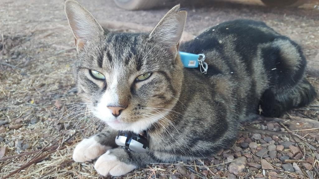
As part of the Domestic Cat Monitoring and Awareness in Alice Springs project, we fitted the kitties out with GPS-trackers, or CatLog devices, by CatTraq. The CatLog (CatTraQ) is a GPS-enabled device that tracks the location of a cat using satellites. The tracker is the size of a matchbox and is connected to a harness, housed within a blue silicone case. The GPS tracker sat between the shoulders of the cat without hindering movement of the cat or causing discomfort.
By fitting domestic cats with a GPS-tracker, we identify the movements of domestic cats when they are away from home. The information can help owners to understand the impact that their cat management is having on the local community and wildlife.
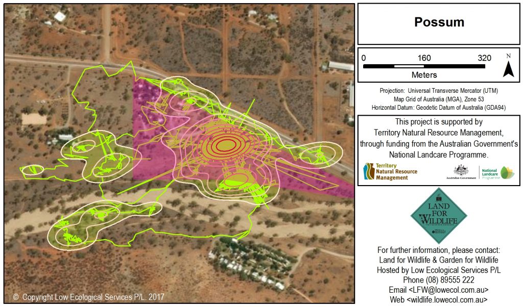
The tracking device was turned on at the start of the monitoring period and left to operate for up to 7 days. Data on the cat’s location was recorded automatically every one minute and stored in the device. Spatial maps were developed using the tracking data, which enabled us to calculate core home ranges and calculate the distances travelled away from home.

Data obtained shows that cats roam further from home than the owners had anticipated and has sparked conversation regarding responsible domestic cat ownership. For example, Possum travelled 500 m from home and had a home range of 25 hectares. He spent 30 % of his time outside of the property boundary – visiting river systems, native wildlife habitat, roadside verges, and neighbours.
The average tracking period per cat was 7 days, producing on average 3,901 GPS-tracked locations per unit. According to the trackers, cats were recorded outside of the property boundary on 47 % of occasions, with 53 % of the tracked points occurring on the owner’s property.
The cats in the tracking project travelled 31 m from home on average, with the furthest distance from home averaging 352 m. One cat travelled as far as 500 m from home. The average cat did not venture further from home at night, compared to during the day, which is contrary to popular belief.
The area covered by cats during the tracking period was 14 hectares on average (ranging from 3.5 Ha to 27.1 Ha), however the core home range area was 1.4 hectares on average (ranging from 0.2 Ha to 10.8 Ha). Home ranges may be overestimated due to inaccurate GPS-signal readings. Large jumps in tracked location were removed from the data if they exceeded a speed of 50 km/h over a 30 second period, however jumps in position that were within the capability of a domestic cat could not be discounted and therefore were retained in the data analysis.
This project is supported by Territory Natural Resource Management, through funding from the Australian Government’s National Landcare Programme.


